How to Check Razor Clam Digging Tides
There’s nothing quite as frustrating for a Washington clammer as meticulously planning a razor clam trip, driving all the way out to the coast, only to discover you’ve completely misjudged the tides. It’s a deflating feeling to arrive at the beach, bucket and shovel in hand, staring out at water that’s far too high to even think about digging. That’s why knowing exactly how to check razor clam digging tides is absolutely essential for a successful, and more importantly, fun outing. This guide will walk you through everything you need to know to accurately predict the best times to hit Washington’s clam-rich beaches.
Understanding Washington's Razor Clam Tides
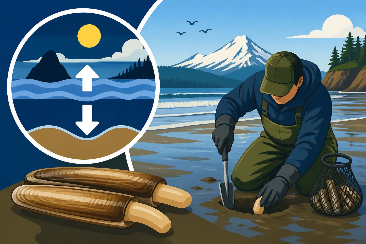
Before we dive into how to check the tides, it’s really important to understand why tides are such a big deal for razor clam digging. Unlike some other shellfish you might find in Puget Sound, razor clams live in the surf zone of open coastal beaches, buried several inches deep in the sand. To get to them, you need the ocean to recede significantly, exposing large swaths of the clam bed. This is where those magical "minus tides" come into play.
A minus tide simply means the water level drops below the average low tide mark. The lower the number (e.g., -1.0 feet, -1.5 feet), the more beach is exposed, and the more access you’ll have to prime clamming grounds. You want to aim for the lowest possible tide during daylight hours or permitted evening digs, as this gives you the largest window and most accessible digging area. Think of it like a giant curtain being pulled back, revealing all the hidden treasures beneath. Without a good minus tide, your chances of hitting your limit plummet, because the clams are simply too far out or too deep under the water line.
Tides, as you probably know, are primarily influenced by the gravitational pull of the moon and, to a lesser extent, the sun. This means they follow predictable patterns tied to lunar cycles. During new moons and full moons, the gravitational forces of the sun and moon align, creating more extreme high and low tides—these are often when we get our best minus tides for clam digging. Understanding this basic science helps you appreciate why certain dates are marked as prime digging days by the Washington Department of Fish and Wildlife (WDFW).
Where to Find Official Razor Clam Digging Tides and Seasons
When it comes to razor clamming in Washington, the absolute authority for both digging seasons and the corresponding tides is the WDFW. They are the folks who manage the resource, ensuring sustainable harvesting, and they'll always be your first stop for accurate information. Relying on unofficial sources or old tide charts can lead to a wasted trip, or worse, a violation.
The WDFW website is incredibly user-friendly and is updated regularly with announcements regarding upcoming digs. They publish approved digging dates for specific beaches, and crucially, they also provide the exact low tide times and heights for those approved days. These announcements are critical because razor clam seasons are not set in stone for the entire year; rather, they are announced incrementally based on clam population assessments and marine toxin levels. You can’t just show up to the beach any old time and expect to dig; there must be an open season. For a complete overview of when these seasons typically occur, you might find our guide on Razor Clam Digging Seasons and Tides particularly helpful.
In addition to WDFW, the National Oceanic and Atmospheric Administration (NOAA) offers highly detailed and scientifically precise tide predictions. While WDFW’s announcements are great for telling you when and where you can dig, NOAA’s charts offer a more granular look at the tide fluctuations throughout the day for specific coastal locations. Many experienced diggers cross-reference WDFW announcements with NOAA data to get a comprehensive picture, especially if they plan to be on the beach for an extended period. This dual-source approach ensures you're working with the most accurate and up-to-date information available.
Step-by-Step Guide to Checking Tides Online
Now for the practical part! Let’s walk through how to actually check those all-important tides using the most reliable online resources. This will ensure you’re never caught off guard again.
Utilizing the WDFW Website for Digging Announcements
- Start with the WDFW Razor Clam Page: Head directly to the official WDFW website and navigate to their razor clam digging page. This page is usually updated frequently during the fall, winter, and spring digging seasons. Look for sections like "Upcoming Razor Clam Digs" or "Coastal Razor Clam Seasons."
- Identify Approved Digs and Beaches: WDFW will list specific dates and the beaches that are open for digging. For example, you might see an announcement like: "Long Beach, Copalis, Twin Harbors, Mocrocks open for digging October 15-18."
- Note the Low Tide Time and Height: Crucially, next to each approved date, WDFW provides the exact low tide time and the tide height (e.g., "Oct. 15, Long Beach: 7:15 AM, -1.2 feet"). This is your golden ticket! You want to be on the beach about an hour to an hour and a half before the listed low tide, giving yourself plenty of time to get set up and maximize your digging window as the tide continues to drop. Remember, the lower the minus tide, the better.
- Check for Emergency Closures: Always, always double-check the WDFW website right before you leave for your trip. Emergency closures due to high marine toxin levels (like domoic acid) or other unforeseen circumstances can happen quickly. What was open yesterday might be closed today. This vigilance is part of being a responsible clammer. For more general regulatory information, our comprehensive guide on Washington Fishing Regulations Every Angler Should Know can be a valuable resource.
Diving Deeper with NOAA Tide Predictions
Once you have your WDFW-approved dates and low tide windows, you can refine your plan using NOAA's more detailed tide charts.
- Access the NOAA Tides & Currents Website: Go to NOAA's official Tides & Currents website. It can seem a bit overwhelming at first, but it's incredibly powerful.
- Select Your Region and Station: You'll need to select your region (e.g., "Washington") and then choose the closest tide station to your intended digging beach. For instance, if you're heading to Long Beach, you'd look for stations like "Grays Harbor Entrance, WA" or "North Cove, Willapa Bay, WA" and then adjust mentally for the specific beach. While not directly on the ocean, these stations provide excellent predictive data for the general area. If you're targeting specific razor clam beaches, our article on Razor Clams on Washington's Ocean Beaches has more location-specific tips.
- Generate a Tide Chart: Input your desired date range. NOAA will generate a detailed chart showing all high and low tides for that period, complete with exact times and heights.
- Interpret the Data: Look for the "Low" tide entries. Compare these times and heights to the WDFW announcements. NOAA's data is often extremely precise, sometimes showing fractions of a foot difference, which can be useful for planning your arrival time down to the minute. You'll notice how the tide drops, pauses at its lowest point (the "slack low"), and then slowly starts to come back in. Knowing this allows you to strategically position yourself on the beach and work efficiently during the prime digging window. Remember, the tide always comes back in, and it can do so surprisingly fast on flat beaches.
Tools and Apps for On-the-Go Tide Information
While the WDFW and NOAA websites are your authoritative sources, having tide information at your fingertips when you're out and about can be incredibly convenient. This is where mobile apps and traditional tide books shine.
Mobile Tide Apps
There's a plethora of tide apps available for both iOS and Android devices, many of which are free or very low cost. These apps pull data from sources like NOAA, presenting it in an easy-to-digest format.
- Ease of Use: Most apps feature intuitive interfaces with graphical tide charts, moon phases, and sometimes even current weather. You can often save your favorite clamming beaches for quick access.
- Offline Access: Some premium versions allow you to download tide charts for offline use, which is invaluable on remote coastal beaches where cell service can be spotty or non-existent. Imagine being out on a chilly morning at Mocrocks, wondering if you have another 30 minutes before the tide turns, and being able to check instantly without signal.
- Customization: Many apps let you customize alerts for low tides, ensuring you don't miss your prime digging window.
- Popular Options: Apps like "Tides Near Me," "Surf Report & Forecast" (which often includes tide data), and "My Tide Times" are popular choices. Do a quick search on your phone's app store and read reviews to find one that suits your needs.
Traditional Tide Books
For those who prefer a physical backup or enjoy the simplicity of a printed chart, traditional tide books are still very much a thing. You can often find these at local sporting goods stores, bait shops near coastal towns, or even online. For example, a quick search on Amazon will reveal a variety of regional tide books specifically tailored for the Pacific Northwest coast. These are reliable and don't require battery power or cell service, making them a trusty companion in any weather.
- Reliability: A physical tide book is impervious to dead batteries or lack of signal.
- Simplicity: No need to navigate menus or websites; just flip to the correct date and location.
- Cons: Can be cumbersome to carry if you prefer to travel light, and they obviously can’t be updated mid-season if emergency rule changes occur (another reason to always check WDFW online before you leave home!).
Markdown Table: Comparing Tide-Checking Methods
To help you decide which method works best for you, here's a quick comparison:
| Method | Accuracy | Ease of Use | Cost | Additional Features | Best For |
|---|---|---|---|---|---|
| WDFW Website | Excellent (official) | Very easy | Free | Official season dates, daily limits, rule changes | Confirming legal digging dates and times |
| NOAA Website | Extremely high | Moderate (detailed) | Free | Hourly tide predictions, current data, graphs | In-depth planning, understanding tide dynamics |
| Mobile Tide Apps | High (NOAA source) | High | Free/Low | GPS-based station finding, alerts, offline access | On-the-go checks, quick reference |
| Physical Tide Books | High (NOAA source) | High | Low | Moon phases, current charts (static) | Reliable backup, no tech needed |
No matter which method you choose, the key is consistency and verification. Always cross-reference with the WDFW website for actual open seasons and specific beach information. Equipping yourself with the right knowledge and tools will transform your clamming trips from hopeful guesses into highly productive, enjoyable outings. Knowing Tools You Need for Razor Clam Digging can also greatly enhance your success once you’re on the beach. Good luck, and happy digging!
Disclaimer
Please remember that fishing and shellfish regulations, including those for razor clams, can change frequently. Always consult the official Washington Department of Fish and Wildlife (WDFW) website for the most current rules, emergency closures, and season information before heading out. This guide is for informational purposes only and does not supersede official regulations.